Geolocate

Gangi topographic map

Click on the map to display elevation.

About this map

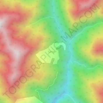
Name: Gangi topographic map, elevation, terrain.

Location: Gangi, Ghansali, Tehri Garhwal, Uttarakhand, India (30.61560 78.83120 30.65560 78.87120)

Average elevation: 2,767 m

Minimum elevation: 2,169 m

Maximum elevation: 3,369 m

Gear up for your next adventure:

🥘Camping Cookware Set - Compact nesting pots and pans for trail cooking
🧦Crew Hiking Socks - Comfortable socks for long-distance hikes
🥾Hiking Leggings - Comfortable leggings for outdoor activities
🧥Waterproof Hiking Jacket - Protect yourself from rain and wind while hiking
🧭Orienteering Kit - Tools for map reading and navigation in the wild

As an Amazon Associate, this site earns from qualifying purchases at no extra cost to you.