

Illingen topographic map
Click on the map to display elevation.
Illingen
The municipality (Gemeinde) of Illingen is located at the eastern edge of the Enzkreis district, within the state of Baden-Württemberg and Federal Republic of Germany. It covers an area of 29.36 square kilometers (11.34 sq mi) that lies within the metropolitan areas of Karlsruhe and Pforzheim. Illingen is physically located on the Keuper Uplands, just north of the Enz valley, between the Neckar basin [de] and the hilly Stromberg region. The largest watercourses within the municipality are the Schmiebach and Metter rivers. The lowest elevation in the municipality, 208 meters (682 ft) NN, lies along the Schmie while the highest, 395 meters (1,296 ft) NN, is the top of the Burgberg in the west.
About this map
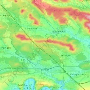
Name: Illingen topographic map, elevation, terrain.
Location: Illingen, Enzkreis, Baden-Württemberg, 75428, Germany (48.93638 8.86926 49.02132 8.94922)
Average elevation: 279 m
Minimum elevation: 202 m
Maximum elevation: 437 m