Geolocate

Deming topographic map

Click on the map to display elevation.

About this map

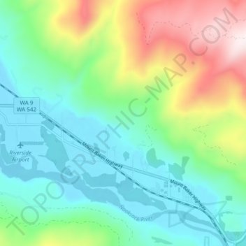
Name: Deming topographic map, elevation, terrain.

Location: Deming, Whatcom County, Washington, United States (48.81761 -122.27651 48.86228 -122.20146)

Average elevation: 274 m

Minimum elevation: 46 m

Maximum elevation: 820 m

Other topographic maps

Click on a map to view its topography, its elevation and its terrain.

Gear up for your next adventure:

🪑Ultralight Camping Stool - Compact seating for rest stops during long hikes
👟Leg Gaiters - Keep debris, mud, and snow out of your boots
🎒Fully Waterproof Backpack - Total protection for photography gear and electronics
🧥Waterproof Jacket - Lightweight rain jackets for hiking and outdoor activities
🧴First Aid Kit - Essential first aid supplies for outdoor emergencies

As an Amazon Associate, this site earns from qualifying purchases at no extra cost to you.