Geolocate

Niijima topographic map

Click on the map to display elevation.

About this map

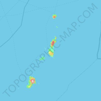
Name: Niijima topographic map, elevation, terrain.

Location: Niijima, Oshima Subprefecture, Tokyo, Japan (34.20317 138.97235 34.52203 139.54481)

Average elevation: 3 m

Minimum elevation: 0 m

Maximum elevation: 554 m

Gear up for your next adventure:

🥽Outdoor Goggles - Protective eyewear for outdoor activities
🧦Thermal Socks - Warm socks for winter hiking or camping
🧊Portable Cooler - Keep food and drinks cold during outdoor adventures
🧥Packable Rain Jacket - Breathable waterproof layer for unpredictable weather
🛏️Camping Sleeping Mat - Comfortable mats for sleeping outdoors

As an Amazon Associate, this site earns from qualifying purchases at no extra cost to you.