Geolocate

Dell topographic map

Click on the map to display elevation.

About this map

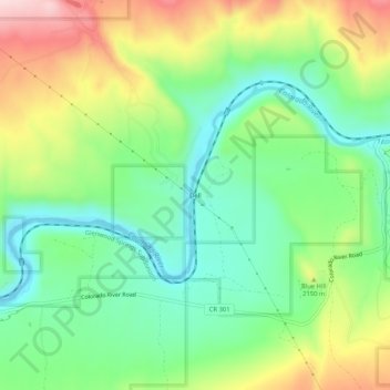
Name: Dell topographic map, elevation, terrain.

Location: Dell, Eagle County, Colorado, United States (39.86554 -106.87643 39.90554 -106.83643)

Average elevation: 2,091 m

Minimum elevation: 1,975 m

Maximum elevation: 2,285 m

Gear up for your next adventure:

👟Leg Gaiters - Keep debris, mud, and snow out of your boots
🥾Waterproof Trail Shoes - Shoes designed to handle wet terrain
Camping Coffee Maker - Brew fresh coffee anywhere on the topographic map
🥾Trail Running Boots - Durable shoes designed for trail running
🔭Compact Monocular - One-handed bird watching and trail spotting

As an Amazon Associate, this site earns from qualifying purchases at no extra cost to you.