
Thank you for supporting this site ❤️
Make a donation
Make a donation
Gear up for your next adventure:
As an Amazon Associate, this site earns from qualifying purchases at no extra cost to you.
Çataksu topographic map
Click on the map to display elevation.
Thank you for supporting this site ❤️
Make a donation
Make a donation
Gear up for your next adventure:
As an Amazon Associate, this site earns from qualifying purchases at no extra cost to you.
About this map
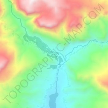
Name: Çataksu topographic map, elevation, terrain.
Location: Çataksu, Olur, Erzurum, Eastern Anatolia Region, Turkey (40.80478 41.91904 40.84478 41.95904)
Average elevation: 1,237 m
Minimum elevation: 906 m
Maximum elevation: 1,738 m
Thank you for supporting this site ❤️
Make a donation
Make a donation
Gear up for your next adventure:
As an Amazon Associate, this site earns from qualifying purchases at no extra cost to you.