
Chilca topographic map
Interactive map
Click on the map to display elevation.
About this map
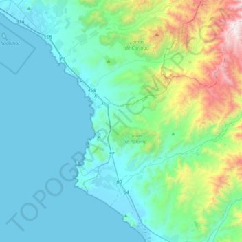
Name: Chilca topographic map, elevation, terrain.
Location: Chilca, Cañete, Lima, Peru (-12.56148 -76.79125 -12.27573 -76.45201)
Average elevation: 324 m
Minimum elevation: 0 m
Maximum elevation: 1,844 m