Geolocate

Collía topographic map

Click on the map to display elevation.

About this map

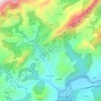
Name: Collía topographic map, elevation, terrain.

Location: Collía, Santitomás, Parres, Asturias, 33540, Spain (43.38821 -5.21261 43.42821 -5.17261)

Average elevation: 220 m

Minimum elevation: 20 m

Maximum elevation: 666 m

Gear up for your next adventure:

📷Outdoor Action Camera - Capture high-elevation views and rugged adventures
Camping Groundsheet - Protect your tent from moisture and dirt
🧤Rechargeable Heated Gloves - Extreme warmth for Canadian winter expeditions
👖Convertible Hiking Pants - Zip-off legs to adapt to changing weather conditions
Camping Tent - Weather-resistant tents suitable for 2 to 6 people

As an Amazon Associate, this site earns from qualifying purchases at no extra cost to you.