Geolocate

Villmergen topographic map

Click on the map to display elevation.

About this map

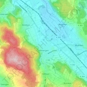
Name: Villmergen topographic map, elevation, terrain.

Location: Villmergen, Bezirk Bremgarten, Aargau, Switzerland (47.32355 8.21174 47.37969 8.26543)

Average elevation: 498 m

Minimum elevation: 405 m

Maximum elevation: 722 m

Gear up for your next adventure:

Camping Groundsheet - Protect your tent from moisture and dirt
🔦LED Flashlight - Powerful and long-lasting flashlight for camping and emergencies
🧭GPS Tracker - Track your location in remote areas safely
🧦Hiking Liner Socks - Thin base layer to prevent friction and blisters
🩹Moleskin Blister Pads - Direct protection for painful foot pressure points

As an Amazon Associate, this site earns from qualifying purchases at no extra cost to you.