
Make a donation
Gear up for your next adventure:
As an Amazon Associate, this site earns from qualifying purchases at no extra cost to you.
Harkenbleck topographic map
Click on the map to display elevation.
Make a donation
Gear up for your next adventure:
As an Amazon Associate, this site earns from qualifying purchases at no extra cost to you.
About this map
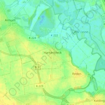
Name: Harkenbleck topographic map, elevation, terrain.
Average elevation: 63 m
Minimum elevation: 53 m
Maximum elevation: 73 m
Make a donation
Gear up for your next adventure:
As an Amazon Associate, this site earns from qualifying purchases at no extra cost to you.
Other topographic maps
Click on a map to view its topography, its elevation and its terrain.
Ihme
Deutschland > Niedersachsen > Region Hannover > Hemmingen
In Höhe der Bahnstrecke Hannover–Altenbeken (am Schnittpunkt der hannoverschen Stadtteile Ricklingen, Linden-Süd und Calenberger Neustadt) mündet der Schnelle Graben in die Ihme, deren Abfluss dadurch um ein Vielfaches vergrößert wird. Der Schnelle Graben beginnt in Höhe der Mitte des Maschsees und…
Average elevation: 65 m
Make a donation
Gear up for your next adventure:
As an Amazon Associate, this site earns from qualifying purchases at no extra cost to you.
Hemmingen-Westerfeld
Deutschland > Niedersachsen > Region Hannover > Hemmingen
Average elevation: 57 m