Geolocate

Lanao topographic map

Click on the map to display elevation.

About this map

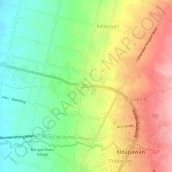
Name: Lanao topographic map, elevation, terrain.

Location: Lanao, Kidapawan, Cotabato, Soccsksargen, 9400, Philippines (7.00480 125.06005 7.04480 125.10005)

Average elevation: 242 m

Minimum elevation: 172 m

Maximum elevation: 324 m

Other topographic maps

Click on a map to view its topography, its elevation and its terrain.

Pulangi River

Philippines > Cotabato > Kidapawan

Average elevation: 440 m

Matingao River

Philippines > Cotabato > Kidapawan > Balabag

Average elevation: 605 m

Gear up for your next adventure:

🥾Waterproof Trail Shoes - Shoes designed to handle wet terrain
🧭GPS Handheld Device - Reliable GPS navigation for outdoor adventures
🧦Hiking Socks - Moisture-wicking and comfortable socks for long hikes
🔪Outdoor Multitool - Versatile tool for repairs and food prep in the wild
🧥Packable Rain Jacket - Breathable waterproof layer for unpredictable weather

As an Amazon Associate, this site earns from qualifying purchases at no extra cost to you.