Geolocate

Jones Crossroads topographic map

Click on the map to display elevation.

About this map

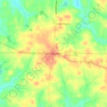
Name: Jones Crossroads topographic map, elevation, terrain.

Location: Jones Crossroads, Harris County, Georgia, United States (32.84957 -85.05466 32.88957 -85.01466)

Average elevation: 229 m

Minimum elevation: 200 m

Maximum elevation: 253 m

Other topographic maps

Click on a map to view its topography, its elevation and its terrain.

Hamilton

United States > Georgia > Harris County

Average elevation: 247 m

Shiloh

United States > Georgia > Harris County

Average elevation: 264 m

Waverly Hall

United States > Georgia > Harris County

Average elevation: 217 m

Whitesville

United States > Georgia > Harris County

Average elevation: 208 m

Pine Mountain

United States > Georgia > Harris County

Average elevation: 274 m

Gear up for your next adventure:

🔦LED Headtorch - Bright and durable light for night activities
💡LED Camping Lantern - Illuminate your campsite with long-lasting lanterns
🦟Insect Repellent - Keep mosquitoes and black flies away in wooded areas
🔋Solar Power Bank - Keep your GPS and devices charged during long outdoor trips
🔪Outdoor Multitool - Versatile tool for repairs and food prep in the wild

As an Amazon Associate, this site earns from qualifying purchases at no extra cost to you.