
Camp Pendleton South topographic map
Click on the map to display elevation.
About this map
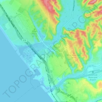
Name: Camp Pendleton South topographic map, elevation, terrain.
Average elevation: 30 m
Minimum elevation: -1 m
Maximum elevation: 133 m
Other topographic maps
Click on a map to view its topography, its elevation and its terrain.
Case Springs Dam
United States > California > San Diego County > Marine Corps Base Camp Pendleton
Average elevation: 655 m
Camp Pendleton
United States > California > San Diego County > Marine Corps Base Camp Pendleton
Average elevation: 24 m