Geolocate

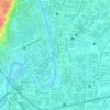
Tumana topographic map

Click on the map to display elevation.

About this map

Name: Tumana topographic map, elevation, terrain.

Location: Tumana, District II, Marikina, Eastern Manila District, Metro Manila, 1806, Philippines (14.65072 121.08571 14.66527 121.10279)

Average elevation: 21 m

Minimum elevation: 2 m

Maximum elevation: 96 m

Other topographic maps

Click on a map to view its topography, its elevation and its terrain.
flood prone

Philippines > Marikina

Average elevation: 27 m

Marikina River Park

Philippines > Marikina

Average elevation: 14 m

Marikina Riverbanks

Philippines > Marikina

Average elevation: 26 m

Gear up for your next adventure:

🧢Hiking Sun Hat - Wide-brimmed protection for exposed mountain ridges
⛺Lightweight Backpacking Tent - Compact tent for efficient hiking trips
🚲Heavy Duty Bike Lock - Secure your bike at the trailhead or during stops
⛺Family Camping Tent - Spacious tent suitable for family camping trips
🧴Waterproofing Spray - Restore the DWR coating on jackets and tents

As an Amazon Associate, this site earns from qualifying purchases at no extra cost to you.