Geolocate

Tafalla topographic map

Click on the map to display elevation.

About this map
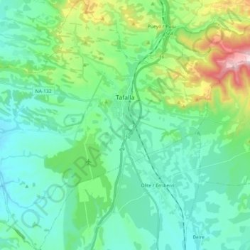
Name: Tafalla topographic map, elevation, terrain.

Location: Tafalla, Erdialdea / Zona Media, Navarre, Spain (42.44692 -1.79439 42.57916 -1.61527)

Average elevation: 453 m

Minimum elevation: 337 m

Maximum elevation: 872 m

Gear up for your next adventure:

🥾Approach Shoes - Shoes designed for climbing approaches and rugged trails
🌡️Emergency Mylar Blankets - Compact thermal protection for unexpected nights outdoors
🛏️Sleeping Bag - Warm and compact sleeping bags for outdoor camping
⛺Camping Tent - Weather-resistant tents suitable for 2 to 6 people
💧Hydration Pack - Hands-free hydration system for long hikes

As an Amazon Associate, this site earns from qualifying purchases at no extra cost to you.