
Thank you for supporting this site ❤️
Make a donation
Make a donation
Gear up for your next adventure:
As an Amazon Associate, this site earns from qualifying purchases at no extra cost to you.
Rongal topographic map
Click on the map to display elevation.
Thank you for supporting this site ❤️
Make a donation
Make a donation
Gear up for your next adventure:
As an Amazon Associate, this site earns from qualifying purchases at no extra cost to you.
About this map
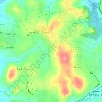
Name: Rongal topographic map, elevation, terrain.
Location: Rongal, Setién, Orejo, Kantabrien, 39719, Spanien (43.40731 -3.74377 43.42731 -3.72377)
Average elevation: 36 m
Minimum elevation: 0 m
Maximum elevation: 90 m
Thank you for supporting this site ❤️
Make a donation
Make a donation
Gear up for your next adventure:
As an Amazon Associate, this site earns from qualifying purchases at no extra cost to you.