
Thank you for supporting this site ❤️
Make a donation
Make a donation
Gear up for your next adventure:
As an Amazon Associate, this site earns from qualifying purchases at no extra cost to you.
Tetanchet topographic map
Click on the map to display elevation.
Thank you for supporting this site ❤️
Make a donation
Make a donation
Gear up for your next adventure:
As an Amazon Associate, this site earns from qualifying purchases at no extra cost to you.
About this map
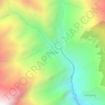
Name: Tetanchet topographic map, elevation, terrain.
Location: Tetanchet, Parbati Kunda, Rasuwa, Bagmati Province, Nepal (28.19507 85.26144 28.23507 85.30144)
Average elevation: 2,671 m
Minimum elevation: 1,808 m
Maximum elevation: 3,866 m
Thank you for supporting this site ❤️
Make a donation
Make a donation
Gear up for your next adventure:
As an Amazon Associate, this site earns from qualifying purchases at no extra cost to you.