Geolocate

Dahijuri topographic map

Click on the map to display elevation.

About this map

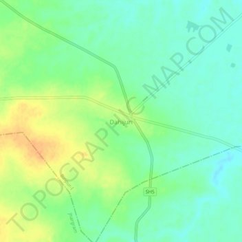
Name: Dahijuri topographic map, elevation, terrain.

Location: Dahijuri, Binpur-I, Jhargram District, West Bengal, India (22.48218 86.97109 22.52218 87.01109)

Average elevation: 64 m

Minimum elevation: 50 m

Maximum elevation: 85 m

Gear up for your next adventure:

🛏️Sleeping Bag - Warm and compact sleeping bags for outdoor camping
🧥Thermal Layer - Insulating layer for cold outdoor conditions
🧢Hiking Hat - Sun-protective and breathable hats for long treks
🥾Trail Hiking Boots - Supportive boots for rough trails
🧼Travel Hand Sanitizer - Keep hands clean when water is scarce

As an Amazon Associate, this site earns from qualifying purchases at no extra cost to you.