Geolocate

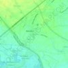
Calibutbut topographic map

Click on the map to display elevation.

About this map

Name: Calibutbut topographic map, elevation, terrain.

Location: Calibutbut, Bacolor, Pampanga, Central Luzon, 2001, Philippines (15.08474 120.59353 15.12004 120.60916)

Average elevation: 64 m

Minimum elevation: 46 m

Maximum elevation: 85 m

Other topographic maps

Click on a map to view its topography, its elevation and its terrain.

Talba

Philippines > Pampanga > Bacolor

Average elevation: 6 m

Parulog

Philippines > Pampanga > Bacolor

Average elevation: 12 m

San Antonio

Philippines > Pampanga > Bacolor

Average elevation: 18 m

Santa Ines

Philippines > Pampanga > Bacolor

Average elevation: 8 m

Potrero

Philippines > Pampanga > Bacolor

Average elevation: 38 m

Parulog

Philippines > Pampanga > Bacolor

Average elevation: 12 m

San Antonio

Philippines > Pampanga > Bacolor

Average elevation: 18 m

Santa Ines

Philippines > Pampanga > Bacolor

Average elevation: 8 m

Parulog

Philippines > Pampanga > Bacolor

Average elevation: 12 m

Gear up for your next adventure:

🔨Vehicle Emergency Tool - Safety tool for remote road trips to trailheads
🦶Anti-Blister Balm - Prevents friction and hotspots during long ascents
🧶550 Survival Paracord - Versatile utility cord for emergency repairs and rigging
🛏️Camping Sleeping Mat - Comfortable mats for sleeping outdoors
🧥Softshell Jacket - Windproof and breathable jacket for hiking

As an Amazon Associate, this site earns from qualifying purchases at no extra cost to you.