
Make a donation
Gear up for your next adventure:
As an Amazon Associate, this site earns from qualifying purchases at no extra cost to you.
Neukölln topographic map
Click on the map to display elevation.
Make a donation
Gear up for your next adventure:
As an Amazon Associate, this site earns from qualifying purchases at no extra cost to you.
Neukölln
Bereits im 19. Jahrhundert zeigte sich mit dem schnellen Bevölkerungswachstum die Notwendigkeit eines umfangreichen Schulbauprogramms. Gegen Ende des Jahrhunderts waren auf Betreiben des Gemeinderats neben der höheren Bildungsanstalt Städtische Realschule mit Progymnasium jeweils sieben Gemeindeschulen und zwar getrennt nach Knaben und Mädchen errichtet worden. Dazu kam noch je eine Schule der katholischen und der evangelischen Kirchengemeinde sowie eine Fortbildungsschule. Ebenfalls zur Verbesserung der Bildung trugen zwei Volksbibliotheken bei.
Make a donation
Gear up for your next adventure:
As an Amazon Associate, this site earns from qualifying purchases at no extra cost to you.
About this map
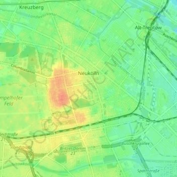
Name: Neukölln topographic map, elevation, terrain.
Location: Neukölln, Berlin, Deutschland (52.45876 13.40608 52.49587 13.47855)
Average elevation: 43 m
Minimum elevation: 26 m
Maximum elevation: 67 m
Make a donation
Gear up for your next adventure:
As an Amazon Associate, this site earns from qualifying purchases at no extra cost to you.