
Ocotal topographic map
Click on the map to display elevation.
Ocotal
Characterised by steep hills in the north and south, plateaus in the west and a valley in the center. It lies at an altitude of 500 metres (1,640 feet) above sea level.
About this map
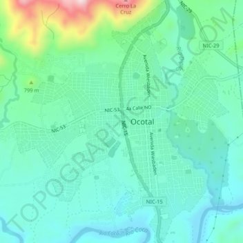
Name: Ocotal topographic map, elevation, terrain.
Location: Ocotal, Ocotal (Municipio), Nueva Segovia, 45887, Nicaragua (13.61375 -86.49767 13.65278 -86.46201)
Average elevation: 624 m
Minimum elevation: 535 m
Maximum elevation: 938 m
Other topographic maps
Click on a map to view its topography, its elevation and its terrain.
Cerro Chachagua
Nicaragua > Nueva Segovia > Wiwilí de Nueva Segovia (Municipio)
Average elevation: 901 m