Geolocate

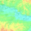
Pulau Tengah topographic map

Click on the map to display elevation.

About this map

Name: Pulau Tengah topographic map, elevation, terrain.

Location: Pulau Tengah, Pangean, Kuantan Singingi, Riau, Sumatra, Indonesia (-0.45113 101.65722 -0.41113 101.69722)

Average elevation: 41 m

Minimum elevation: 31 m

Maximum elevation: 68 m

Other topographic maps

Click on a map to view its topography, its elevation and its terrain.

Kuantan Hilir

Indonesia > Riau > Kuantan Singingi

Average elevation: 66 m

Kuantan Tengah

Indonesia > Riau > Kuantan Singingi

Average elevation: 90 m

Kecamatan Inuman

Indonesia > Riau > Kuantan Singingi

Average elevation: 56 m

Gear up for your next adventure:

🧦Outdoor Socks - Durable socks designed for hiking and outdoor sports
🛁Quick-Dry Microfiber Towel - Space-saving towel that dries rapidly on the move
🎒Backpack Rain Cover - External shield to keep your entire pack dry
💧Hydration Pack - Hands-free hydration system for long hikes
⛺Tent Footprint - Protect tent floor and increase durability

As an Amazon Associate, this site earns from qualifying purchases at no extra cost to you.