
Thank you for supporting this site ❤️
Make a donation
Make a donation
Gear up for your next adventure:
As an Amazon Associate, this site earns from qualifying purchases at no extra cost to you.
Kong topographic map
Click on the map to display elevation.
Thank you for supporting this site ❤️
Make a donation
Make a donation
Gear up for your next adventure:
As an Amazon Associate, this site earns from qualifying purchases at no extra cost to you.
About this map
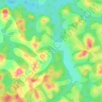
Name: Kong topographic map, elevation, terrain.
Location: Kong, Ngambé-Tikar, Mbam-et-Kim, Centre, Cameroon (5.58990 12.04090 5.62990 12.08090)
Average elevation: 863 m
Minimum elevation: 827 m
Maximum elevation: 911 m
Thank you for supporting this site ❤️
Make a donation
Make a donation
Gear up for your next adventure:
As an Amazon Associate, this site earns from qualifying purchases at no extra cost to you.