Geolocate

Ooo topographic map

Click on the map to display elevation.

About this map

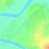
Name: Ooo topographic map, elevation, terrain.

Location: Ooo, Al-Nukhayb Subdistrict, Al-Rutba District, Al-Anbar Governorate, Iraq (32.30929 42.96760 32.30939 42.96770)

Average elevation: 201 m

Minimum elevation: 197 m

Maximum elevation: 207 m

Other topographic maps

Click on a map to view its topography, its elevation and its terrain.
Al-Rutba District

Iraq > Al-Anbar Governorate

Average elevation: 468 m

Al Ubaydi

Iraq > Al-Anbar Governorate

Average elevation: 172 m

Gear up for your next adventure:

👟Leg Gaiters - Keep debris, mud, and snow out of your boots
🧦Outdoor Socks - Durable socks designed for hiking and outdoor sports
🧼Travel Hand Sanitizer - Keep hands clean when water is scarce
🧢Hiking Hat - Sun-protective and breathable hats for long treks
🧭GPS Outdoor Watch - Smart watch for navigation and fitness tracking in nature

As an Amazon Associate, this site earns from qualifying purchases at no extra cost to you.