
Vejo topographic map
Click on the map to display elevation.
Vejo
Está situado a 643 metros de altitud en la vertiente de una gran montaña y en la margen izquierda del río que baja del puerto de San Glorio. Dista cinco kilómetros y seiscientos metros de la capital municipal, La Vega.
About this map
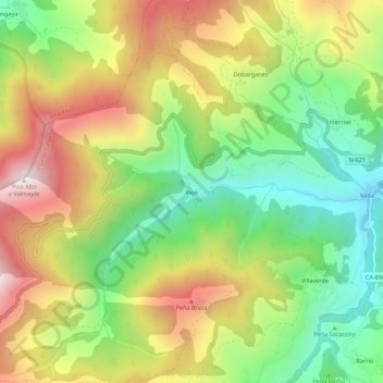
Name: Vejo topographic map, elevation, terrain.
Location: Vejo, Vega de Liébana, Cantabria, 39577, España (43.07073 -4.72047 43.11073 -4.68047)
Average elevation: 930 m
Minimum elevation: 539 m
Maximum elevation: 1,418 m