
Thank you for supporting this site ❤️
Make a donation
Make a donation
Gear up for your next adventure:
As an Amazon Associate, this site earns from qualifying purchases at no extra cost to you.
maloti topographic map
Click on the map to display elevation.
Thank you for supporting this site ❤️
Make a donation
Make a donation
Gear up for your next adventure:
As an Amazon Associate, this site earns from qualifying purchases at no extra cost to you.
About this map
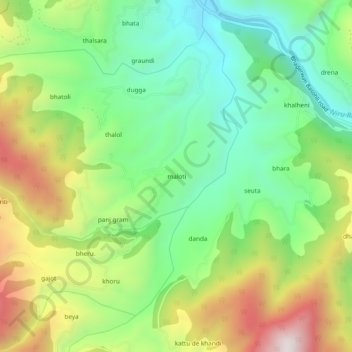
Name: maloti topographic map, elevation, terrain.
Location: maloti, Bhaderwah, Doda district, Jammu and Kashmir, India (33.02878 75.58911 33.06878 75.62911)
Average elevation: 1,525 m
Minimum elevation: 1,194 m
Maximum elevation: 2,058 m
Thank you for supporting this site ❤️
Make a donation
Make a donation
Gear up for your next adventure:
As an Amazon Associate, this site earns from qualifying purchases at no extra cost to you.