Geolocate

Bardenitz topographic map

Click on the map to display elevation.

About this map

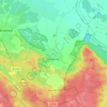
Name: Bardenitz topographic map, elevation, terrain.

Location: Bardenitz, Treuenbrietzen, Potsdam-Mittelmark, Brandenburg, Deutschland (52.03522 12.90289 52.12094 12.99658)

Average elevation: 71 m

Minimum elevation: 41 m

Maximum elevation: 117 m

Other topographic maps

Click on a map to view its topography, its elevation and its terrain.

Gear up for your next adventure:

🧭GPS Handheld Device - Reliable GPS navigation for outdoor adventures
💧Reusable Water Bottle - Durable water bottles for hydration on trails
🥾Trekking Boots - Durable boots for long-distance trekking
🥾Mountain Hiking Shoes - Shoes with superior grip for mountainous terrain
🚲Bike Repair Kit - Essential tools for on-trail mechanical issues

As an Amazon Associate, this site earns from qualifying purchases at no extra cost to you.