Geolocate

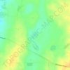
Maitland topographic map

Click on the map to display elevation.

About this map

Name: Maitland topographic map, elevation, terrain.

Location: Maitland, Yorke Peninsula Council, South Australia, 5573, Australia (-34.42969 137.54199 -34.27599 137.83436)

Average elevation: 129 m

Minimum elevation: 11 m

Maximum elevation: 243 m

Other topographic maps

Click on a map to view its topography, its elevation and its terrain.
Gear up for your next adventure:

🥫Freeze-Dried Meals - Lightweight, high-calorie nutrition for multi-day treks
🧦Hiking Socks - Moisture-wicking and comfortable socks for long hikes
🧊Portable Cooler - Keep food and drinks cold during outdoor adventures
🥾Waterproof Hiking Shoes - Durable shoes for wet and rugged trails
💡Portable Camping Lamp - Rechargeable lamp for campsite lighting

As an Amazon Associate, this site earns from qualifying purchases at no extra cost to you.