Bawana topographic map
Click on the map to display elevation.
Bawana
Bawana has an average elevation of 213 metres (698 feet). It is surrounded by the villages of Nangal Thakran, Bajitpur, Daryapur, Majra Dabas, Pooth Khurd, Holabmi Khurd, Kheda Khurd, Holambi Kalan, Sultanpur Dabas and Ghogha. The area of the village under farming was 52000 bigha, but now most of this land has been acquired by the Delhi Government for industrial use. Bawana, with its khadar soil, is very fertile, with a high water table due to the western Yamuna canal and the high density of ponds. The climate in the region is extreme, with very high temperatures in the summer and almost zero level temperatures in the winter months. J.J colony, a slum area inside Dilshad Colony, is separated from Bawana by a canal.
About this map
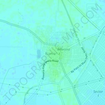
Name: Bawana topographic map, elevation, terrain.
Location: Bawana, Narela, Delhi, Outer North Delhi, Delhi, India (28.79453 77.02893 28.80514 77.04308)
Average elevation: 219 m
Minimum elevation: 217 m
Maximum elevation: 223 m
Other topographic maps
Click on a map to view its topography, its elevation and its terrain.