
Gajapati topographic map
Interactive map
Click on the map to display elevation.
About this map
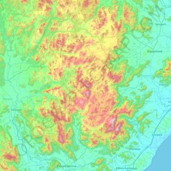
Name: Gajapati topographic map, elevation, terrain.
Location: Gajapati, Odisha, India (18.75373 83.79397 19.62786 84.44796)
Average elevation: 342 m
Minimum elevation: 0 m
Maximum elevation: 1,492 m
Other topographic maps
Click on a map to view its topography, its elevation and its terrain.