Geolocate

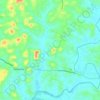
Puzhathi topographic map

Click on the map to display elevation.

About this map

Name: Puzhathi topographic map, elevation, terrain.

Location: Puzhathi, Kannur, Kerala, 670005, India (11.87829 75.36533 11.91829 75.40533)

Average elevation: 16 m

Minimum elevation: -4 m

Maximum elevation: 45 m

Other topographic maps

Click on a map to view its topography, its elevation and its terrain.
Kannur

India > Kerala > Kannur

Kannur has an elevation of 1.02 metres or 3.3 feet along the coast of the Laccadive Sea, with a sandy coastal area. The city has an 8 kilometres (5.0 mi)-long seashore and a 3 kilometres (1.9 mi)-long beach at Payyambalam. Kannur is located north of Kozhikode, south of Kasargod and Mangalore, west of the…

Average elevation: 14 m

Pallikunnu

India > Kerala > Kannur

Average elevation: 14 m

Chakkarakal

India > Kerala > Kannur > Movancherry > Kavinmoola

Average elevation: 35 m

Peralassery

India > Kerala > Kannur > Kadachira

Average elevation: 21 m

Eachur

India > Kerala > Kannur > Kanachery

Average elevation: 27 m

Puzhathi

India > Kerala > Kannur

Average elevation: 19 m

Thana

India > Kerala > Kannur > Kannur

Average elevation: 20 m

Gear up for your next adventure:

💡Compact LED Flashlight - Powerful and portable flashlight for outdoor use
⛺Camping Groundsheet - Protect your tent from moisture and dirt
☕Camping Coffee Maker - Brew fresh coffee anywhere on the topographic map
🧦Outdoor Socks - Durable socks designed for hiking and outdoor sports
🧥Insulated Jacket - Keep warm in cold outdoor conditions

As an Amazon Associate, this site earns from qualifying purchases at no extra cost to you.