Geolocate

Alangulam topographic map

Click on the map to display elevation.

Alangulam

Alangulam is located at 8°52′N 77°30′E / 8.87°N 77.5°E / 8.87; 77.5. It is situated at an average elevation of 127 metres (416 feet).

Wikipedia (CC-BY-SA 3.0)

About this map

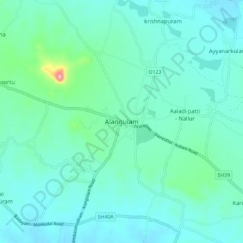
Name: Alangulam topographic map, elevation, terrain.

Location: Alangulam, Tenkasi District, Tamil Nadu, 627851, India (8.82676 77.45623 8.90676 77.53623)

Average elevation: 120 m

Minimum elevation: 93 m

Maximum elevation: 276 m

Gear up for your next adventure:

🔪Outdoor Multitool - Versatile tool for repairs and food prep in the wild
🧴Bear Spray Holster - Quick-access carry for essential Canadian wilderness safety
👟Sport Hiking Sandals - Breathable footwear for water crossings and camp rest
🧤Thermal Hiking Gloves - Grip-enhanced gloves for cold-weather altitude trekking
🥾Trekking Boots - Durable boots for long-distance trekking

As an Amazon Associate, this site earns from qualifying purchases at no extra cost to you.