Geolocate

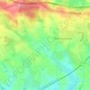
Les Pommiers topographic map

Click on the map to display elevation.

About this map

Name: Les Pommiers topographic map, elevation, terrain.

Location: Les Pommiers, Loiron, Loiron-Ruillé, Laval, Mayenne, Pays de la Loire, France métropolitaine, 53320, France (48.03709 -0.94072 48.07709 -0.90072)

Average elevation: 134 m

Minimum elevation: 96 m

Maximum elevation: 169 m

Other topographic maps

Click on a map to view its topography, its elevation and its terrain.
Gear up for your next adventure:

💧Reusable Water Bottle - Durable water bottles for hydration on trails
🥾Mountain Hiking Shoes - Shoes with superior grip for mountainous terrain
🔭Compact Monocular - One-handed bird watching and trail spotting
🥾Trekking Boots - Durable boots for long-distance trekking
🕶️Polarized Sunglasses - Protect your eyes with durable polarized lenses

As an Amazon Associate, this site earns from qualifying purchases at no extra cost to you.