Geolocate

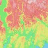
Lac Donlon topographic map

Click on the map to display elevation.

About this map

Name: Lac Donlon topographic map, elevation, terrain.

Location: Lac Donlon, Rivière-aux-Outardes, Manicouagan, Côte-Nord, Québec, Canada (49.30645 -68.44057 49.32318 -68.42276)

Average elevation: 230 m

Minimum elevation: 181 m

Maximum elevation: 302 m

Other topographic maps

Click on a map to view its topography, its elevation and its terrain.

Manic 5.

Canada > Québec > Manicouagan > Rivière-aux-Outardes

Average elevation: 349 m

Lac Hermas

Canada > Québec > Manicouagan > Rivière-aux-Outardes

Average elevation: 475 m

Lac Alice

Canada > Québec > Manicouagan > Rivière-aux-Outardes

Average elevation: 314 m

Lac Limite

Canada > Québec > Manicouagan > Rivière-aux-Outardes

Average elevation: 357 m

Lac Berté

Canada > Québec > Manicouagan > Rivière-aux-Outardes

Average elevation: 432 m

Lac Boston

Canada > Québec > Manicouagan > Rivière-aux-Outardes

Average elevation: 374 m

Lac Savane

Canada > Québec > Manicouagan > Rivière-aux-Outardes

Average elevation: 186 m

Gear up for your next adventure:

🥾Trekking Poles - Adjustable trekking poles to reduce knee stress and improve stability
🥾Trail Hiking Boots - Supportive boots for rough trails
🏃Hydration Running Vest - Carry water and maps close to your body for speed
🛶Canoe Life Vest - Safety vest for water sports
🛶Kayak Accessories - Essential gear for safe and fun kayaking adventures

As an Amazon Associate, this site earns from qualifying purchases at no extra cost to you.