Geolocate

Badger Lake topographic map

Click on the map to display elevation.

About this map

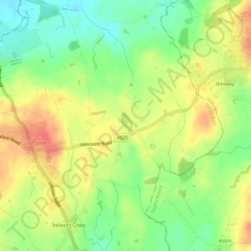
Name: Badger Lake topographic map, elevation, terrain.

Location: Badger Lake, Woore, Shropshire, England, United Kingdom (52.97935 -2.38677 52.98085 -2.38481)

Average elevation: 130 m

Minimum elevation: 104 m

Maximum elevation: 155 m

Gear up for your next adventure:

🦶Anti-Blister Balm - Prevents friction and hotspots during long ascents
🛶Waterproof Dry Bags - Keep electronics and clothes dry during river crossings
🧰Multitool Knife - Compact and versatile tool for outdoor use
🧢Sun Protection Cap - Breathable cap to protect from sun exposure
🧥Ultralight Puffy Jacket - Maximum warmth that packs down to the size of an orange

As an Amazon Associate, this site earns from qualifying purchases at no extra cost to you.