
Sambalpur topographic map
Click on the map to display elevation.
Sambalpur
Sambalpur is located at 21°.27' North Latitude and 83°.58' East Longitude. The average elevation is 150.75 metres (494.6 ft) above the mean sea level. Sambalpur falls under the Zone-3 seismic number, which shows the possibility of an earthquake.
About this map
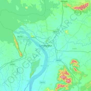
Name: Sambalpur topographic map, elevation, terrain.
Location: Sambalpur, Sambalpur (M), Sambalpur, Odisha, 768001, India (21.31054 83.81615 21.63054 84.13615)
Average elevation: 182 m
Minimum elevation: 127 m
Maximum elevation: 548 m