Geolocate

Meicheng topographic map

Click on the map to display elevation.

About this map

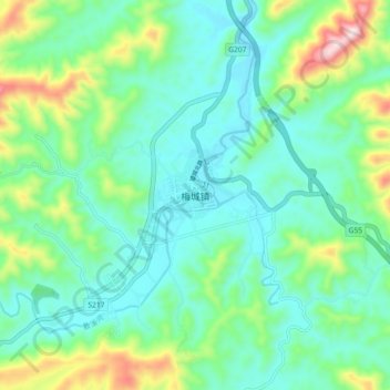
Name: Meicheng topographic map, elevation, terrain.

Location: Meicheng, Anhua County, Yiyang, Hunan, China (28.10207 111.60609 28.18207 111.68609)

Average elevation: 280 m

Minimum elevation: 162 m

Maximum elevation: 642 m

Gear up for your next adventure:

🧥Softshell Jacket - Windproof and breathable jacket for hiking
🥾Lightweight Hiking Shoes - Comfortable shoes for day hikes
🔋Lithium AA Batteries - Long-lasting power that performs in extreme cold
🧥Insulated Jacket - Keep warm in cold outdoor conditions
🧼Travel Hand Sanitizer - Keep hands clean when water is scarce

As an Amazon Associate, this site earns from qualifying purchases at no extra cost to you.