Geolocate

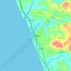
Vaninagara topographic map

Click on the map to display elevation.

About this map

Name: Vaninagara topographic map, elevation, terrain.

Location: Vaninagara, Manjeswaram, Kasaragod, Kerala, India (12.60197 75.12715 12.62150 75.15601)

Average elevation: 96 m

Minimum elevation: 45 m

Maximum elevation: 292 m

Other topographic maps

Click on a map to view its topography, its elevation and its terrain.

Angadimogar

India > Kerala > Manjeswaram

Average elevation: 39 m

Kumbala

India > Kerala > Manjeswaram

Average elevation: 18 m

Mangalpady

India > Kerala > Manjeswaram

Average elevation: 15 m

Challankayam

India > Kerala > Manjeswaram > Permude

Average elevation: 81 m

Uppala

India > Kerala > Manjeswaram

Uppala is located near the Arabian Sea, and has a very low elevation of nine metres. The town is densely populated near the National Highway 66.

Average elevation: 15 m

Gear up for your next adventure:

🪜Heavy Duty Carabiners - Multi-use clips for securing gear to your backpack
🌬️Windproof Camp Stove - Efficient cooking even on exposed mountain peaks
🥾Waterproof Hiking Shoes - Durable shoes for wet and rugged trails
🍽️Titanium Camping Spork - Ultralight and indestructible eating utensil
🚲Heavy Duty Bike Lock - Secure your bike at the trailhead or during stops

As an Amazon Associate, this site earns from qualifying purchases at no extra cost to you.