Geolocate

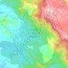
Tholicode topographic map

Click on the map to display elevation.

About this map

Name: Tholicode topographic map, elevation, terrain.

Location: Tholicode, Nedumangad, Thiruvananthapuram, Kerala, 695547, India (8.62525 77.03508 8.66525 77.07508)

Average elevation: 133 m

Minimum elevation: 72 m

Maximum elevation: 301 m

Other topographic maps

Click on a map to view its topography, its elevation and its terrain.
Aryanad

India > Kerala > Nedumangad > Aryanad

Average elevation: 105 m

Wildlife Sanctuary, Peppara

India > Kerala > Nedumangad

Average elevation: 539 m

Manickal

India > Kerala > Nedumangad > Vettinad

Average elevation: 67 m

Gear up for your next adventure:

🧥Waterproof Hiking Jacket - Protect yourself from rain and wind while hiking
🥾Waterproof Hiking Boots - Boots keeping your feet dry in wet conditions
🌬️Windproof Camp Stove - Efficient cooking even on exposed mountain peaks
🧥Packable Rain Jacket - Breathable waterproof layer for unpredictable weather
🥾Hiking Shorts - Breathable shorts suitable for summer hikes

As an Amazon Associate, this site earns from qualifying purchases at no extra cost to you.