Geolocate

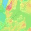
M’Chigeeng topographic map

Click on the map to display elevation.

About this map

Name: M’Chigeeng topographic map, elevation, terrain.

Location: M’Chigeeng, Manitoulin District, Northeastern Ontario, Ontario, P0P 1G0, Canada (45.80758 -82.18124 45.84758 -82.14124)

Average elevation: 216 m

Minimum elevation: 174 m

Maximum elevation: 317 m

Other topographic maps

Click on a map to view its topography, its elevation and its terrain.
Manitoulin Island

Canada > Ontario > Manitoulin District

Average elevation: 194 m

Billings Township

Canada > Ontario > Manitoulin District

Average elevation: 208 m

Gore Bay

Canada > Ontario > Manitoulin District

Average elevation: 211 m

Manitoulin Island

Canada > Ontario > Manitoulin District

Average elevation: 194 m

Manitoulin Island

Canada > Ontario > Manitoulin District

Average elevation: 194 m

Gear up for your next adventure:

🥾Trail Running Shoes - Lightweight and durable shoes for trail running
🔦LED Headlamp - Hands-free lighting for early morning starts or late finishes
🥾Lightweight Hiking Boots - Boots for comfort and mobility on long hikes
🧭GPS Handheld Device - Reliable GPS navigation for outdoor adventures
⛺Lightweight Backpacking Tent - Compact tent for efficient hiking trips

As an Amazon Associate, this site earns from qualifying purchases at no extra cost to you.