Geolocate

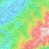
Les Contamines topographic map

Click on the map to display elevation.

About this map

Name: Les Contamines topographic map, elevation, terrain.

Location: Les Contamines, Revel, Grenoble, Isère, Auvergne-Rhône-Alpes, France métropolitaine, 38420, France (45.16653 5.85087 45.20653 5.89087)

Average elevation: 755 m

Minimum elevation: 222 m

Maximum elevation: 1,289 m

Other topographic maps

Click on a map to view its topography, its elevation and its terrain.
38420

France > Auvergne-Rhône-Alpes > Isère > Revel > Les Molettes

Average elevation: 1,038 m

Gear up for your next adventure:

🔭Compact Binoculars - Lightweight optics for scouting trails and wildlife
🧴First Aid Kit - Essential first aid supplies for outdoor emergencies
🔋Lithium AA Batteries - Long-lasting power that performs in extreme cold
🧢Outdoor Cap - Protective cap for sun and rain during hikes
🧳Compression Sacks - Maximize space in your backpack by shrinking gear

As an Amazon Associate, this site earns from qualifying purchases at no extra cost to you.