Geolocate

North Braddock topographic map

Click on the map to display elevation.

About this map

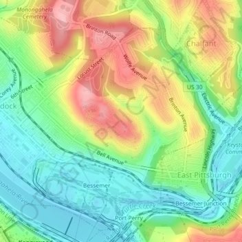
Name: North Braddock topographic map, elevation, terrain.

Location: North Braddock, Allegheny County, Pennsylvania, 15104, United States (40.38947 -79.87181 40.41392 -79.83721)

Average elevation: 282 m

Minimum elevation: 219 m

Maximum elevation: 374 m

Other topographic maps

Click on a map to view its topography, its elevation and its terrain.

Center

United States > Pennsylvania > Allegheny County > Plum

Average elevation: 341 m

Gear up for your next adventure:

Lightweight Camping Tent - Portable shelter optimized for Canadian backcountry camping
🧢Hiking Hat - Sun-protective and breathable hats for long treks
🧴First Aid Kit - Essential first aid supplies for outdoor emergencies
🧦Hiking Liner Socks - Thin base layer to prevent friction and blisters
🍽️Titanium Camping Spork - Ultralight and indestructible eating utensil

As an Amazon Associate, this site earns from qualifying purchases at no extra cost to you.