Geolocate

Hingatmonan topographic map

Click on the map to display elevation.

About this map

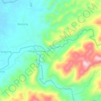
Name: Hingatmonan topographic map, elevation, terrain.

Location: Hingatmonan, Cebu, Central Visayas, Philippines (10.49755 123.74332 10.53755 123.78332)

Average elevation: 113 m

Minimum elevation: 11 m

Maximum elevation: 317 m

Gear up for your next adventure:

🧴Sunscreen SPF - Broad-spectrum sunscreen for outdoor activities
🥾Mountaineering Boots - Supportive boots for climbing and high-altitude hiking
🛶Kayak Dry Bag - Waterproof storage for kayaking adventures
🧴Insect Repellent - Protect yourself from bugs during outdoor adventures
🔦LED Headlamp - Hands-free lighting for early morning starts or late finishes

As an Amazon Associate, this site earns from qualifying purchases at no extra cost to you.