Geolocate

Beku topographic map

Click on the map to display elevation.

About this map

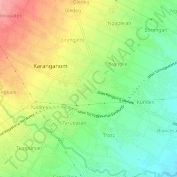
Name: Beku topographic map, elevation, terrain.

Location: Beku, Klaten, Central Java, Indonesia (-7.67154 110.61321 -7.63154 110.65321)

Average elevation: 194 m

Minimum elevation: 148 m

Maximum elevation: 254 m

Gear up for your next adventure:

🧴First Aid Kit - Essential first aid supplies for outdoor emergencies
🎒Hiking Backpack - Lightweight and ergonomic backpacks for day hikes or multi-day treks
🥾Waterproof Hiking Boots - Essential footwear for rugged terrain and wet Canadian trails
Lightweight Backpacking Tent - Compact tent for efficient hiking trips
Camping Coffee Maker - Brew fresh coffee anywhere on the topographic map

As an Amazon Associate, this site earns from qualifying purchases at no extra cost to you.