Geolocate

Harrling topographic map

Click on the map to display elevation.

About this map

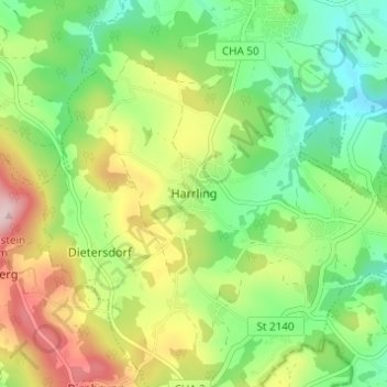
Name: Harrling topographic map, elevation, terrain.

Location: Harrling, Zandt, Landkreis Cham, Bayern, 93499, Deutschland (49.11487 12.69547 49.15487 12.73547)

Average elevation: 508 m

Minimum elevation: 406 m

Maximum elevation: 672 m

Gear up for your next adventure:

🦟Insect Repellent - Keep mosquitoes and black flies away in wooded areas
Camping Essentials - All-in-one gear for a comfortable camping trip
🥾Trail Hiking Shoes - Durable shoes designed for rugged trails
🔪Outdoor Multitool - Versatile tool for repairs and food prep in the wild
🧭Orienteering Kit - Tools for map reading and navigation in the wild

As an Amazon Associate, this site earns from qualifying purchases at no extra cost to you.