Geolocate

Des Moines topographic map

Click on the map to display elevation.

About this map

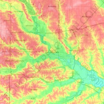
Name: Des Moines topographic map, elevation, terrain.

Location: Des Moines, Polk County, Iowa, 50319, United States (41.43103 -93.76467 41.75103 -93.44467)

Average elevation: 271 m

Minimum elevation: 225 m

Maximum elevation: 312 m

Gear up for your next adventure:

🥾Lightweight Hiking Boots - Boots for comfort and mobility on long hikes
🧊Insulated Water Bottle - Keeps drinks cold in summer and prevents freezing in winter
🥾Mountaineering Boots - Supportive boots for climbing and high-altitude hiking
🧥Waterproof Hiking Jacket - Protect yourself from rain and wind while hiking
🚲MTB Frame Bag - Carry tools and maps directly on your bicycle frame

As an Amazon Associate, this site earns from qualifying purchases at no extra cost to you.