Geolocate

Brodarica topographic map

Click on the map to display elevation.

About this map

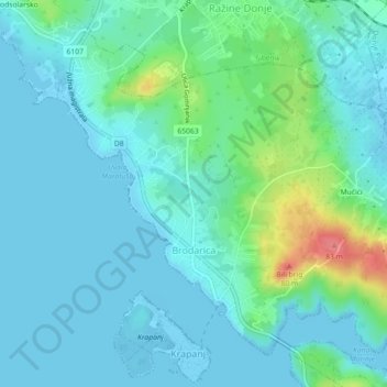
Name: Brodarica topographic map, elevation, terrain.

Location: Brodarica, Grad Šibenik, Šibenik-Knin County, 22108, Croatia (43.67187 15.90163 43.69884 15.94637)

Average elevation: 15 m

Minimum elevation: -5 m

Maximum elevation: 79 m

Gear up for your next adventure:

🌬️Windproof Camp Stove - Efficient cooking even on exposed mountain peaks
🧦Hiking Liner Socks - Thin base layer to prevent friction and blisters
🎒Hiking Backpack - Lightweight and ergonomic backpacks for day hikes or multi-day treks
🔋Solar Power Bank - Keep your GPS and devices charged during long outdoor trips
🥾Trail Running Shoes - Lightweight and durable shoes for trail running

As an Amazon Associate, this site earns from qualifying purchases at no extra cost to you.