Geolocate

Penza topographic map

Click on the map to display elevation.

About this map

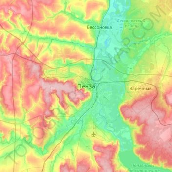
Name: Penza topographic map, elevation, terrain.

Location: Penza, Penza Oblast, Volga Federal District, 4400XX, Russia (53.04000 44.84000 53.36000 45.16000)

Average elevation: 188 m

Minimum elevation: 128 m

Maximum elevation: 274 m

Gear up for your next adventure:

🦌Outdoor Trail Camera - Monitor wildlife activity near your favorite spots
🧼Travel Hand Sanitizer - Keep hands clean when water is scarce
🧴Waterproofing Spray - Restore the DWR coating on jackets and tents
💧Reusable Water Bottle - Durable water bottles for hydration on trails
💡Portable Camping Lamp - Rechargeable lamp for campsite lighting

As an Amazon Associate, this site earns from qualifying purchases at no extra cost to you.