
Thank you for supporting this site ❤️
Make a donation
Make a donation
Gear up for your next adventure:
As an Amazon Associate, this site earns from qualifying purchases at no extra cost to you.
Al-Masakin topographic map
Click on the map to display elevation.
Thank you for supporting this site ❤️
Make a donation
Make a donation
Gear up for your next adventure:
As an Amazon Associate, this site earns from qualifying purchases at no extra cost to you.
About this map
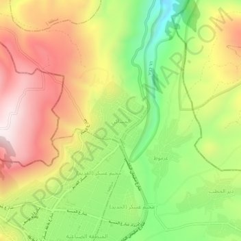
Name: Al-Masakin topographic map, elevation, terrain.
Location: Al-Masakin, Area B, West Bank, 803, Palestinian Territory (32.20868 35.28217 32.24868 35.32217)
Average elevation: 556 m
Minimum elevation: 199 m
Maximum elevation: 916 m
Thank you for supporting this site ❤️
Make a donation
Make a donation
Gear up for your next adventure:
As an Amazon Associate, this site earns from qualifying purchases at no extra cost to you.