
Tseri topographic map
Interactive map
Click on the map to display elevation.
About this map
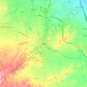
Name: Tseri topographic map, elevation, terrain.
Location: Tseri, Nicosia, 2480, Cyprus (35.03270 33.28467 35.11270 33.36467)
Average elevation: 264 m
Minimum elevation: 171 m
Maximum elevation: 398 m